

GOLD STAR!!!!!!!!!!! On the new version."
Jacob Miller, TerraNext
QuickLog - Advanced Features
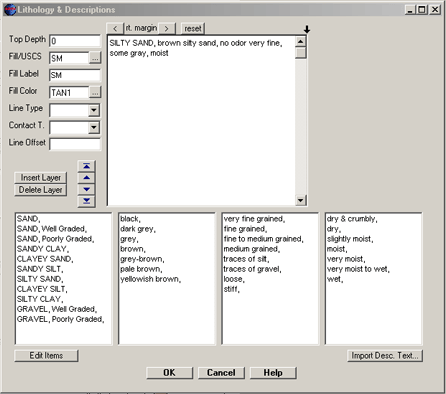
Fast, Standardized Description Entry
To speed entering soil and rock descriptions, you may set-up "pick-lists" of often used
description phrases (ex. "SAND, Poorly Graded," "yellowish brown," "traces of silt," etc). Then,
you simply click on these phrases to have them placed in the description text editor,
above. Also, you can use this method to standardize description entry so that your logs become more consistent.
QuickLog Field Version
Originally, we aimed to replace the logbook with direct data entry into a field computer. But, most of our clients don't want to
spend the extra money on ruggedized computers that usually cost $3000 or more. If you happen to own a ruggedized computer
such as a Trimble Yuma or Panasonic Toughbook, you can save time by creating logs while in the field using the "field" version of QuickLog.
This way, you leave the job site with your borehole logs complete - it saves a lot of "back and forth" time if you would otherwise be passing
them off to a data entry person in the office. Whether you use a field computer, pencil/paper, or a cellphone to collect data in the field,
using GeoWriter can save you a lot of time. Click here to read our article about
using GeoWriter with these three methods.
Create Custom Fill Patterns using any Paint Program
The program includes 65 fill patterns (click here to see the default fill pattern guide).
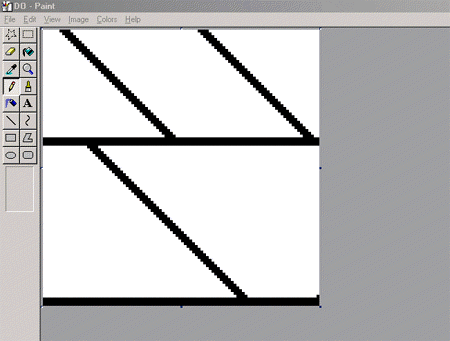
Each fill pattern is a BMP file which you can open
and modify using any paint program. This format enables us (and you) to create a
wider variety of fill patterns than a CAD program can offer (since CAD can only
use vector fill patterns). Any BMP file can be used as a fill pattern --
you could even take digital photos of your soil samples and use them as fill
patterns. Below is the dolomite .BMP file in a paint program:
Export Logs to Other Graphics Programs & CAD, if Necessary
After you've completed your log, you can simply print it, or you can export it to one of the following graphic
formats: DXF, BMP, WMF, EMF.
Easy to Use File Format, Export to ASCII Text or AGS Data Formats
Some borehole logging programs require you to save your data in a complex database/library system. With QuickLog however, you don't need a
database programmer as each log is saved as a small ASCII text file (ending in ".BOR"). If you ever need to send it to a client
or colleague, you just email the .BOR file. QuickLog also features database import/export via ASCII text and AGS data formats - so, it
can be used with databases, if needed.
Using QuickGIS, you can also export QuickLog data into other modeling programs such as EVS, GMS, and Arcview.
Drawing Tools
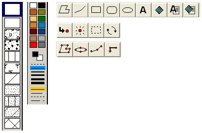
QuickLog features a rich set of drawing tools that enable you to add lines, text, and objects using the mouse, directly on the
preview screen. Need to add a special feature that is not pre-programmed in the software? You can do it quickly using the drawing tools.
Grain Size Analysis - Lithology Log
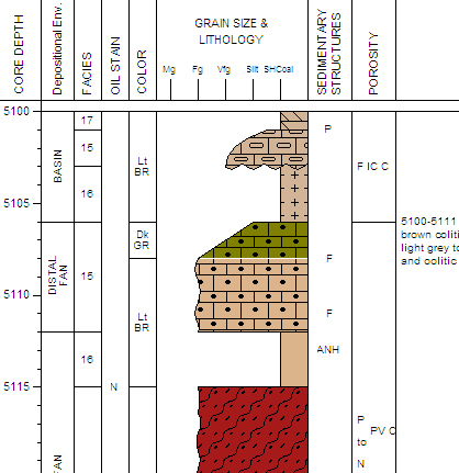
QuickLog offers the highly specialized grain size analysis graphic column - litholgy log.
Below is an example featuring Grain Size Analysis, Porosity, Depositional Environment, Sedimentary Structures, Facies, and Oil Stain.
[Previous Page]


